
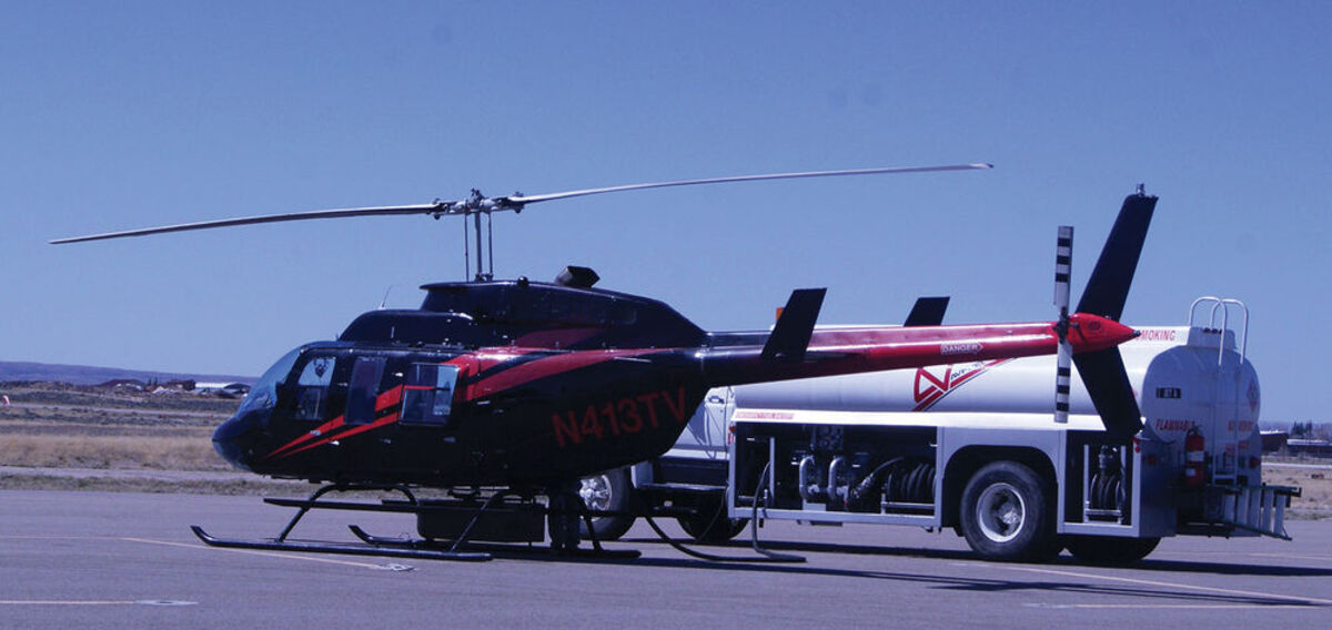
The helicopter conducting the LiDAR survey on Monday was fueling up for Cheyenne after the completed two-and-a-half hours survey.
The black rectangular box is where the LiDAR remote sensor is located on the helicopter.
LiDAR is an extremely efficient way to topographically survey a broad swath, said Craig Kopasz, a civil engineer with PMPC/Engineering Associates.
LiDAR, which stands for Light Detection and Ranging is a remote sensing method used to examine the surface of the earth, according the the National Oceanic and Atmospheric Administration (NOAA) website.
At the April 7 Saratoga Town Council meeting, there some was confusion about what the LiDAR is being used for by a member of the audience.
He thought the LiDAR was for use in Federal Emergency Management Agency (FEMA) use. Mayor Ed Glode explained that the LiDAR has many more advantages and that FEMA is just one of them.
Kopasz explained the LiDAR in much detail more Thursday.
For Kopasz to survey the town without LiDAR it would take an immense amount of time and money to get the same topographic information that the LiDAR provides.
The cost would be significantly more than what it takes with a helicopter or plane to fly over the area.
When the helicopter flew over Saratoga Monday, they used sensors which bounce back a time and distance which gives really accurate elevations and coordinates.
It is taking global positioning system (GPS) data as it flies and high resolution orthorectified photos.
"Basically, it is a picture in real coordinates," Kopasz said. Because of that, PMPC and the town of Saratoga can use the data for planning purposes.
"We use it all the time in Rawlins for surveying," Kopasz said.
The LiDAR data has several uses. For instance, Kopasz explained, a survey to prove that someone is not in a flood plain can be a significant cost. Using the LiDAR survey meets that requirement with a much lower cost.
The manholes in Saratoga were painted white to show up on the photos so that engineers can see the manholes in the photos and draw a line from one to the other to see where the sewer and water lines are located.
Using this method creates a potential to create a map of the water and sewer system, Kopasz said. "Right now we are creating the base foundation for that map."
Once the orthorectified photos are made, engineers can import their surveys into the map, Kopasz explained.
This method is much more reliable than using Google Earth because the error in Google can be significant, but with the orthorectified photos it is extremely accurate.

Reader Comments(0)